Perfect Storm Exercise Information Sheet
A list you can utilize when an Emergency arises

Earthquake Drill Tune to VHF for participation information
Lodi-147.090 offset + pl. 114.8
Tuolumne 9:30 am to 12 pm, 147.945 offset – , pl.107.2
Join us tomorrow, Wednesday, April 10 , for our RATPAC Zoom presentation:
9:00 PM ET / 8:00 PM CT / 7:00 PM MT / 6:00 PM PT / 01:00 UTC
Topic: A Fun & New Way to Learn Morse Code
Presented by Howard Bernstein, WB2UZE ◄ Click on callsign to view QRZ.com page
Mike Padron, N1CC ◄ Click on callsign to view QRZ.com page
Jim Crites, W6JIM ◄ Click on callsign to view QRZ.com page
https://us02web.zoom.us/j/2128884758?pwd=RG94eEY2L3FiMEg0U3ZIWmhXaEdwdz09
Meeting ID: 212 888 4758
Passcode: RATPAC
NOTE: ZOOM Passcode & URL information is now the same for both Wednesday and Thursday’s
Sam – WS6P
ARES Emergency Coordinator – Calaveras County
RACES Radio Officer – Calaveras County
Hm: (209) 293-4010
1st Net Cell: (209) 418-9207
W6WPT Repeater 440.100 + T100
WIRES-X node 33432
For those interested in Radio history the subject matter might interest you
From: “RATPAC Planning” <ratpacplan@gmail.com>
Subject: [EmComm] RATPAC WED: History of Modern Communications Receiver- Part 1
Date: February 6, 2024 at 7:42:40 PM PST
Reply-To: main@SEC-EmComm.groups.io
Join us live Wednesday, February 7 for RATPAC Zoom presentation:
10:00 PM AST / 9:00 PM EDT / 800 PM CDT / 7:00 PM MDT / 6:00 PM PDT / 5:00 PM AKDT / 5:00 PM HADT
and 02:00 AM GMT Thursday
Topic: History of Modern Communications Receiver- Part 1
Presented by Dennis Kidder, W6DQ ◄ Click on callsign to view QRZ.com page
https://us02web.zoom.us/j/2128884758?pwd=RG94eEY2L3FiMEg0U3ZIWmhXaEdwdz09
Meeting ID: 212 888 4758
Passcode: RATPAC
Sent by Sam Hernandez
This should be a good one for everyone using WInlink or other apps that use sound cards.
Cheers & 73,
Dan Sohn, wl7coo
Join us live on Thursday, January 11 for RATPAC Zoom presentation:
10:00 PM AST / 9:00 PM EDT / 800 PM CDT / 7:00 PM MDT / 6:00 PM PDT / 5:00 PM AKDT / 5:00 PM HADT / 02:00 AM GMT Thursday
Topic: V/UHF Winlink on Packet & Vara FM using sound cards.
Presented by Scott Currie NS7C ◄ Click on callsign to view QRZ.com page
Kevin Custer, W3KKC ◄ Click on callsign to view QRZ.com page
■ For past and future Thursday RATPAC emergency communications Presentations, go to: http://tiny.cc/rpem
Referred by
Sam – WS6P
ARES Emergency Coordinator – Calaveras County
RACES Radio Officer – Calaveras County
Hm: (209) 293-4010
Meeting ID: 212 888 4758
Passcode: RATPAC
NOTE: ZOOM Passcode & URL information is now the same for both Wednesday and Thursday’s

Strong Gusty Winds and Dry Conditions
Sam – WS6P
ARES Emergency Coordinator – Calaveras County
RACES Radio Officer – Calaveras County
Hm: (209) 293-4010
1st Net Cell: (209) 418-9207
W6WPT Repeater 440.100 + T100
WIRES-X node 33432
When an earthquake or other major incident occurs, frequently the infrastructure in the surrounding area is knocked out. This creates a so-called “doughnut hole” where people in the most-impacted area cannot provide reports via internet or cell phones. Because of this, USGS partnered with Winlink to provide a way for “Did You Feel It” (DYFI) reports to be submitted via radio. When Winlink DYFI messages are received by USGS, these reports are parsed automatically, and the information is added to their database giving a near-real-time picture of the extent of damage. The SHAKEOUT exercise on October 19 will give USGS a good measure of how effective the Winlink radio reporting system is.
In addition to providing information to USGS, the SHAKEOUT exercise also is being used by FEMA and other agencies to gauge the effectiveness of amateur radio at providing ground truth during incidents. This is from the September 26 FEMA bulletin, which went to all FEMA Regions for their stakeholders:
“Our primary aim of participating in the October 19th SHAKEOUT ‘Did You Feel It’ (DYFI) exercise is to underscore the remarkable proficiency of Winlink. The United States Geological Survey (USGS) will use this Winlink ‘Did You Feel It’ ground truth data to contribute to the calculations of their earthquake intensity assessments when modeling the Modified Mercalli (MMIS) Intensity Scale, a standard index used for earthquake severity (see Figure 1). This data will contribute to event response products, like PAGER, a system that provides fatality and economic loss impact estimates following significant earthquakes, worldwide, and is used by governments, agencies, NGOs, private companies, and citizens.
“A secondary and extremely important purpose for emergency management at all levels to participate in this exercise is to illustrate the capabilities of the Winlink system to provide situational awareness ground truth regardless of the specific information gathered.”
DYFI Winlink submissions will go to USGS, the Winlink team, and partner agencies. They will produce maps showing points of submission, and they will generate summaries for the AAR which will be sent to FEMA, DHS, SHARES, and other interested groups.
In addition to U.S. hams, Winlink DYFI reports will be sent by CISA SHARES members, Air Force MARS members, and hams in Europe, Scandinavia, and other parts of the world.
You can find detailed instructions about how to fill out a Winlink DYFI report and send it via radio at this site. Note to specify QUAKE-23 as a CC address to your submission.
https://winlink.org/sites/default/files/ShakeOutWinlinkExercise_cm6.pdf
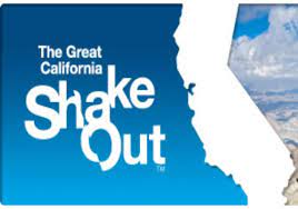
TCARS Earthquake Net Drill
| THURSDAY OCT 19, 2023 10:19 am You can participate in a special annual emergency net with organizations across California. TCARES and TC Office of Emergency Services are planning an emergency NET to demonstrate the TCARES repeater infrastructure during a simulated communications outage following a simulated major earthquake incident. We are looking for MAXIMUM PARTICIPATION! Our goal is to see check-ins from Pinecrest to Jamestown, from Mariposa to Angels Camp, and from Modesto to Yosemite National Park! (AND ALL POINTS IN-BETWEEN) ALL TCARES REPEATERS WILL BE LINKED CHECK-IN format. CONCISE checkins. We are looking for rapid efficient check-ins. After the net is over, general chit-chat may resume. EXAMPLE CHECK IN: Your (location or organization) examples: GMRS/FRS Relays: Many local areas have very active GMRS groups. (Twain Harte, Columbia, Groveland, etc) Local leaders will relay and report how many GMRS contacts were made at the end of the NET. (more instructions on the relay method coming soon) |
SJV ECs or designees please share this with your Volunteers and Amateur Radio Clubs in your Jurisdictions.
Everyone else is free to share it with their Amateur Radio Service Clubs and Groups.
https://winlink.org/sites/default/files/ShakeOutWinlinkExercise_cm6.pdf
If you can follow instructions and have a computer – after downloading Winlink Express from Winlink.org and getting anyone who is using Winlink to help you get started with Telnet mode – the instructions below, updated today, will have you ready to participate in the FEMA sponsored National 2023 Great Shakeout by submitting an Amateur Radio Service Winlink Express “Did You Feel It” (DYFI) Form as close to or after 10:19 AM local time as you can.
Your DYFI will be a tangible contribution to the FEMA Sponsored National 2023 Great Shakeout test use of Winlink Express on a National level..
Be sure to follow the CC: instructions precisely on October 19th.
These step by step instructions are in a downloadable PDF so you can read them as you follow them. The first couple of times.
Practice sending a few DYFI Forms transmissions between now and October 19th.
As long as you have “Exercise” checked you will do no harm.
You can CC:me if you want at wl7coo@winlink.org … or if you have a SHARES Callsign I can be reached at NNA9HD.
Cheers & 73,
..dan sohn
SJV SEC
sohn@sti.net or wl7coo@ winlink.org or NNA9HD